3D Building Scan: Capturing a Place to Project Onto It
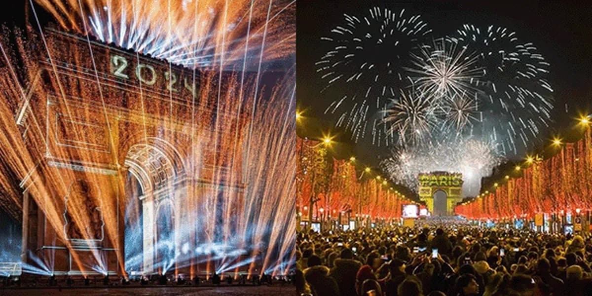
A 3D building scan captures the exact geometry of a facade, a room or a monument as digital data, either from photos (photogrammetry) or from a laser (lidar). The output is a point cloud, then a 3D model, that reproduces the place down to the millimetre. In construction it feeds surveys and BIM. I use it for one reason: to prepare a projection that lands exactly on the building, before a single projector is rigged.
I have done architectural mapping for 15 years. The Arc de Triomphe, seven editions. When you project onto a carved facade, an architect's drawing is not enough: drawings lie, cornices have shifted, the stone has relief the PDF ignores. A 3D scan gives you the real volume. This guide covers how you scan a place to project onto it, in the order I do it on site, and where it differs from a standard surveyor's job.
There are two families of scan, and the choice comes down to what is in your hands and how much time you have on site.
Photogrammetry rebuilds the volume from overlapping photos. You walk around the facade, drone or DSLR, 60 to 80 % overlap between frames, and software like Agisoft Metashape recomputes the 3D from parallax. Upside: the gear costs about the price of a decent camera, and you get the texture along with the geometry. Downside: it hates uniform surfaces, glass, polished metal, and changing light ruins it. A white facade in midday sun is the worst case.
Lidar is a laser measuring the distance to every point, 500,000 to 2 million measurements per second depending on the machine. A static tripod scanner (Leica RTC360, Faro Focus) captures a station in a few minutes, millimetre-class accuracy, and it ignores ambient light. It works at night, which suits a mapping shoot. Against it: cost, a scanner rents for a few hundred a day, and the raw cloud is heavy to process.
For mapping, the rule I apply: photogrammetry when the budget is tight and the facade is textured, lidar when the place is large, dark, or the geometry has to be flawless. Either way, the final output is the same object, a point cloud I then turn into a projectable surface. The 3D scanner buying guide goes into the hardware detail.
Nobody mentions this in tutorials, and it is where the job is won. Before I pull out the scanner, I walk the building with one question in mind: where will the audience watch from, and where will the projectors fire from.
That changes everything, because I am not scanning a building to archive it, I am scanning it for a specific view. The back face of a monument, if no projector covers it and nobody sees it, I do not waste three stations on it. Conversely, a cornice that will block part of the image from the projector's firing point, I scan finely, because that is what casts a shadow across the mapping if I miss it.
In practice, during recon I note: the planned projector positions, the audience viewpoints, the access (cherry picker, neighbouring roof for an overhead lidar station), and the zones I know are trouble. Shop windows, water, foliage moving in the wind. One hour of recon saves half a day of re-scanning.
The question that keeps coming up is "what scan resolution". The right answer depends on the detail you need to project, not the maximum the machine can do.
The benchmark I use: point density has to be finer than the projected pixel size on the surface. If my projectors lay down a 10 mm pixel on the facade, a cloud with 5 mm point spacing is plenty, and scanning at 1 mm only bloats a file my machine then has to chew through. On a large building seen from far, a 15 mm pixel is sharp from across the square, so I scan looser and save a lot of processing time.
The opposite trap exists too. On a museum interior you approach within a metre, with a projected pixel of 2 to 3 mm, you need a genuinely dense cloud, several overlapping lidar stations, or the edges of the set smear and the alignment shows. Density is decided during recon, from the audience distance and the projection distance, not when you configure the scanner.
Occlusions are the holes in the scan. A column hides the wall behind it, a balcony masks the underside of the cornice, a lamppost gets in the way. From a single station, you will never see what sits behind an obstacle. The fix is mechanical: multiply viewpoints, shift the scanner a few metres, and above all scan from the projector's axis. What the projector will not see, I do not need to map; what it will see, I must have in the cloud. Aligning the scan axis with the firing axis is the shortcut a standard survey never takes, because it aims for completeness, not the projection view.
Georeferencing means anchoring the scan in a stable frame. For mapping, I am not after absolute GPS coordinates, I am after a 3D model that is to scale and oriented like the real building, so the projector positions I place in software match the real positions on site. Registration targets stuck on the facade, or identifiable features (window corners, stone edges), let you stitch stations together and verify scale. A scan 3 % too large, and every throw and coverage calculation is wrong.
The raw cloud is not directly usable for projecting. You clean it (remove the crowd, cars, foliage), mesh it into a surface, often decimate it so it runs in prep software. This chain, from scan to workable data, starts from photos or laser and lands on a clean mesh or cloud. If you are new to this, start with the photogrammetry and 3D scanning for mapping guide, the pillar that ties these steps together.
Once the model is ready, the scan finally does what I built it for: placing the projectors. That is exactly what Lumeo is for, where I import the model from the scan, drop the machines into the 3D scene, and see where the image lands, where the shadows fall, and how many lux I get on each zone, before a single projector is rented. The scan gives you the ground, the simulator gives you the battle plan.
And on rig day, that model is the reference for projector alignment: you already know where each machine should land, you are not improvising the warp at 3 a.m. on a lift. The scan is the layer that comes before all the calibration.
Worth noting, the same data also feeds BIM and architectural surveys if the place needs it elsewhere. That is not my use, but a well-made scan is reusable, and it can tip the decision toward a dense lidar scan over quick photogrammetry.
Two resources I recommend without reservation to start. The Formlabs photogrammetry guide, clear on shooting and comparing software. And the Wikipedia definition of photogrammetry, to understand parallax before buying anything.
Cases where I told clients not to spend a cent on scanning:
For the logical next step, once the place is scanned, see how to turn the cloud into a clean surface and how it all feeds back into projection in the 3D scanning and mapping guide. And if you are torn between photogrammetry and lidar for your building, write to me. I have scanned places that never should have been, and missed relief I should have scanned. Both mistakes get paid for on the wall, the night of the show.
Cookies and privacy Learn more
This site uses cookies to measure audience and improve your experience. You can accept, reject or customize your preferences at any time. Learn more